Our Services
-
![]()
Commercial Surveys
A LiDAR (Light Detection and Ranging) drone survey creates exceptionally detailed digital models of landscape, vegetation, buildings and other assets. This makes it a valuable process for mapping and surveying inaccessible areas, landscapes, quarries, roads and infrastructure, forestry, floodplains and complex structures such as powerlines and manufacturing plant.
-
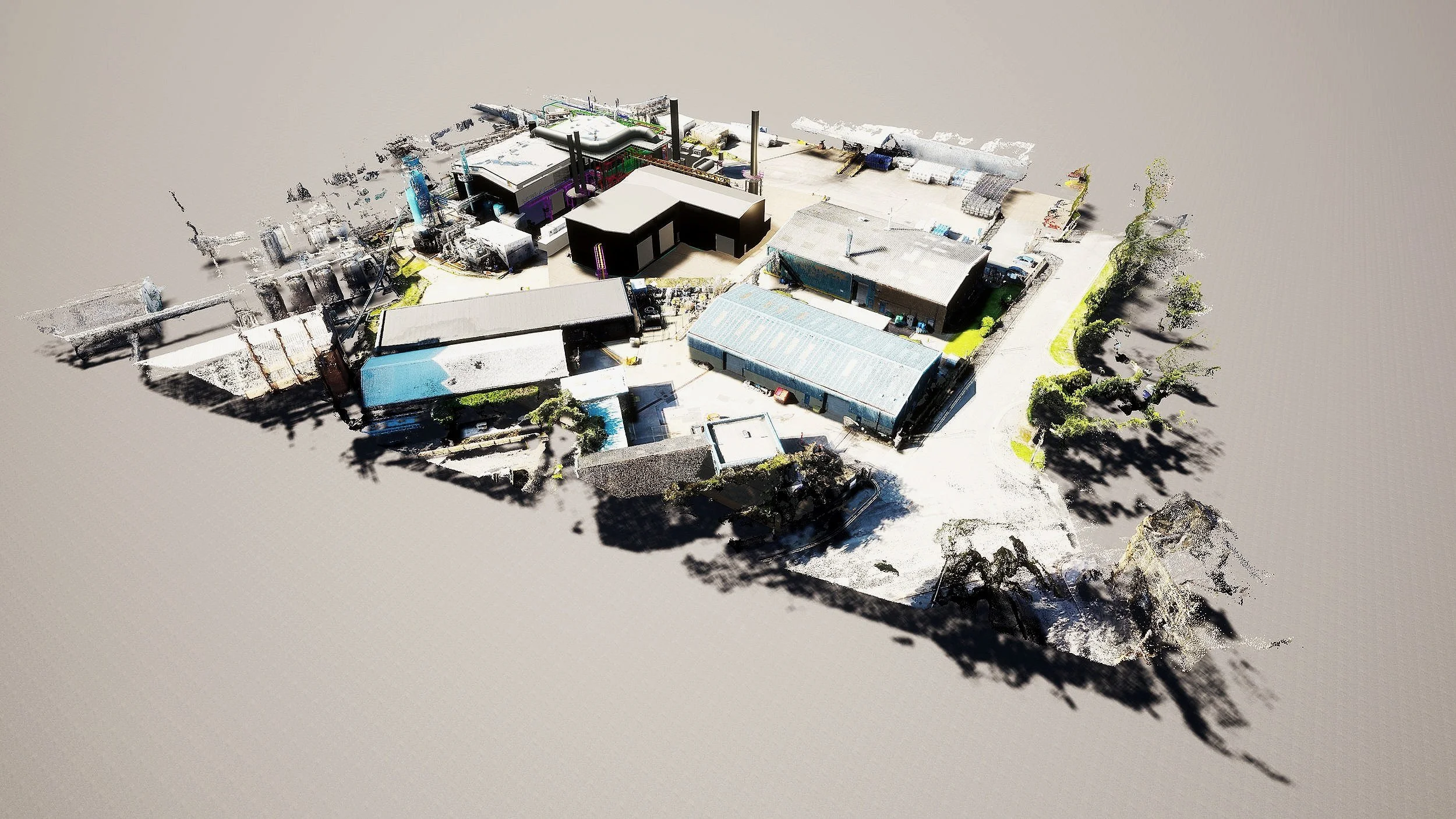
![]()
Exterior Photogrammetry
Detailed 4k drone scans are digitally converted into 3d models, extremely useful for off-site viewing, these models can be combined with CAD produced building models providing in-situ renders, showing the surrounding environment.
-
![]()
Internal Laser Surveys
The latest in laser scanning equipment is employed for creating 4K resolution interior imagery and 3D information models, which can be used for measuring, remote viewing for real estate and virtual tour presentations.
-
![]()
BIM
Building Information Modelling (BIM) is a process that encourages collaborative working between all the disciplines involved in design, construction, maintenance and use of buildings. All parties share the same information simultaneously, in the same format.
-
![]()
Digital Twin
The creation of a digital replica in high detail from a range of source material which can then be utilised by architects, designers, contractors and project managers, shared across formats and viewed remotely, saving on site visits.
-
![]()
Fire Safety Design
Buildings designed in the UK is heavily regulated by a raft of legislative guides & EN/BS codes and compliances, also an approved “ Engineered Solution” may be required to meet Full Building regulation Part C, this is especially relevant to high rise buildings, we can help guide through, and design to meet these stipulations, and using the digital model, identify any areas for concern.